
Mount Benson Hike Directions (Nanaimo, BC)
Mount Benson – Nanaimo’s Grouse Grind
Mount Benson is a popular hiking route in Nanaimo, BC that I have done several times. I like to think of it as the Grouse Grind of Vancouver Island. It is quite challenging and a great workout.
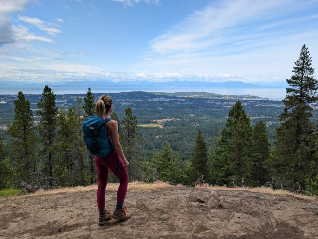
Mount Benson is the tallest mountain in the area, so you get amazing 360 views of the city of Nanaimo, Strait of Georgia, the Coast Mountains and the surrounding mountains behind Mt. Benson. On clear days you can even see Mt Baker.

Mind the whiskey jacks. They are quick to get your snacks!
Mt Benson Hike Info
- Distance: ~8 km return
- Difficulty: Hard – steep trail with some minor scrambling
- Time: 3 – 5 hours
- Elevation gain: – 730 m
- Highest Point – 1023 m Summit
- Best Time To Go: Has great lighting later in the day
- Dog Friendly: Dogs are allowed on leash but there are steep sections
This hike is fairly well signed and easy to navigate as long as you pay attention to the numerous signs. If you don’t feel like hiking all of MT Benson there is a pretty respectable lookout about 1/2 way up!

Mt Benson Hike Directions
The trail is quite difficult because you are mainly ascending for 4 straight kilometers. It usually takes us about 3 hours to do the whole hike, but it is always good to give yourself extra time.
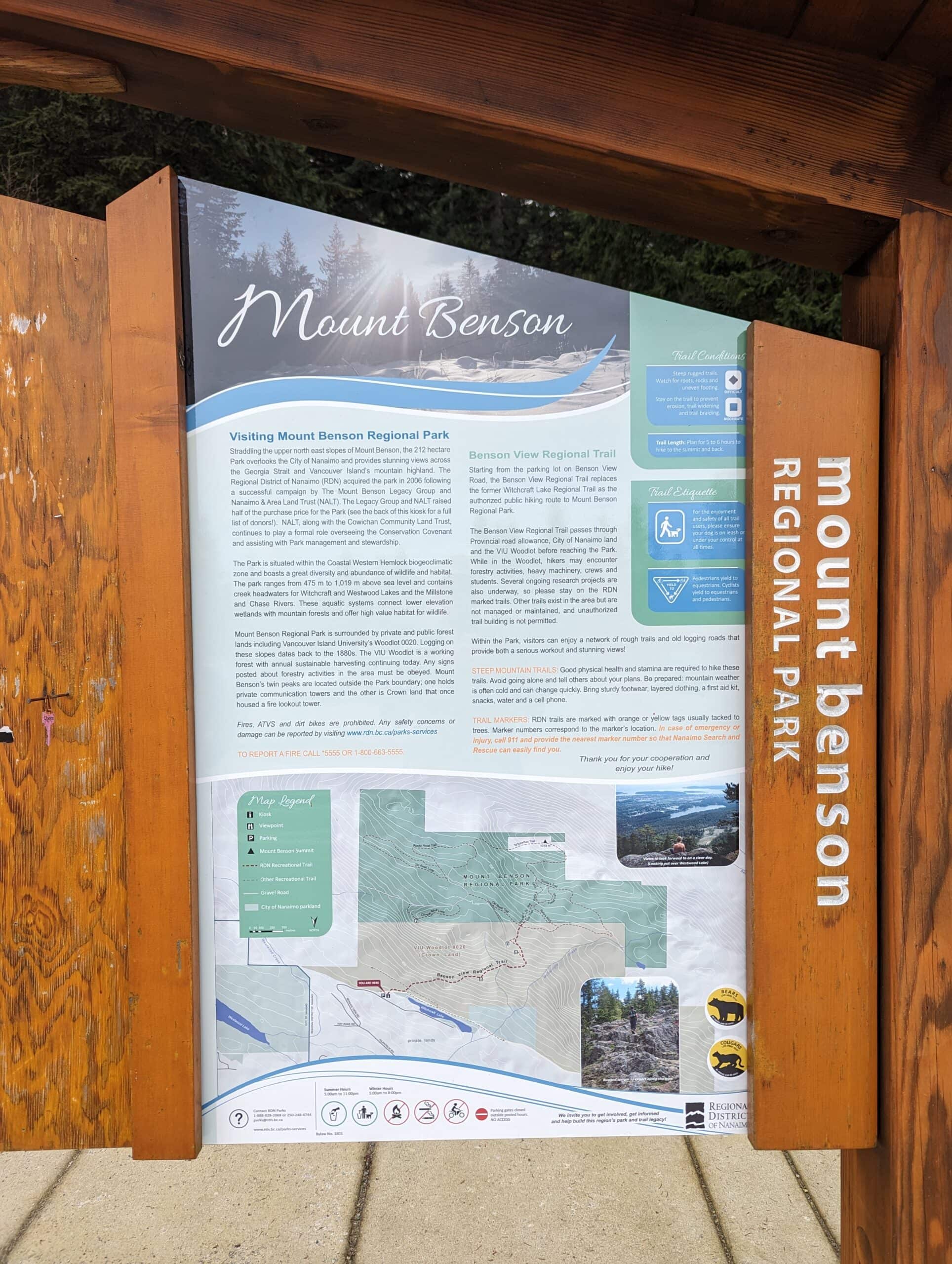
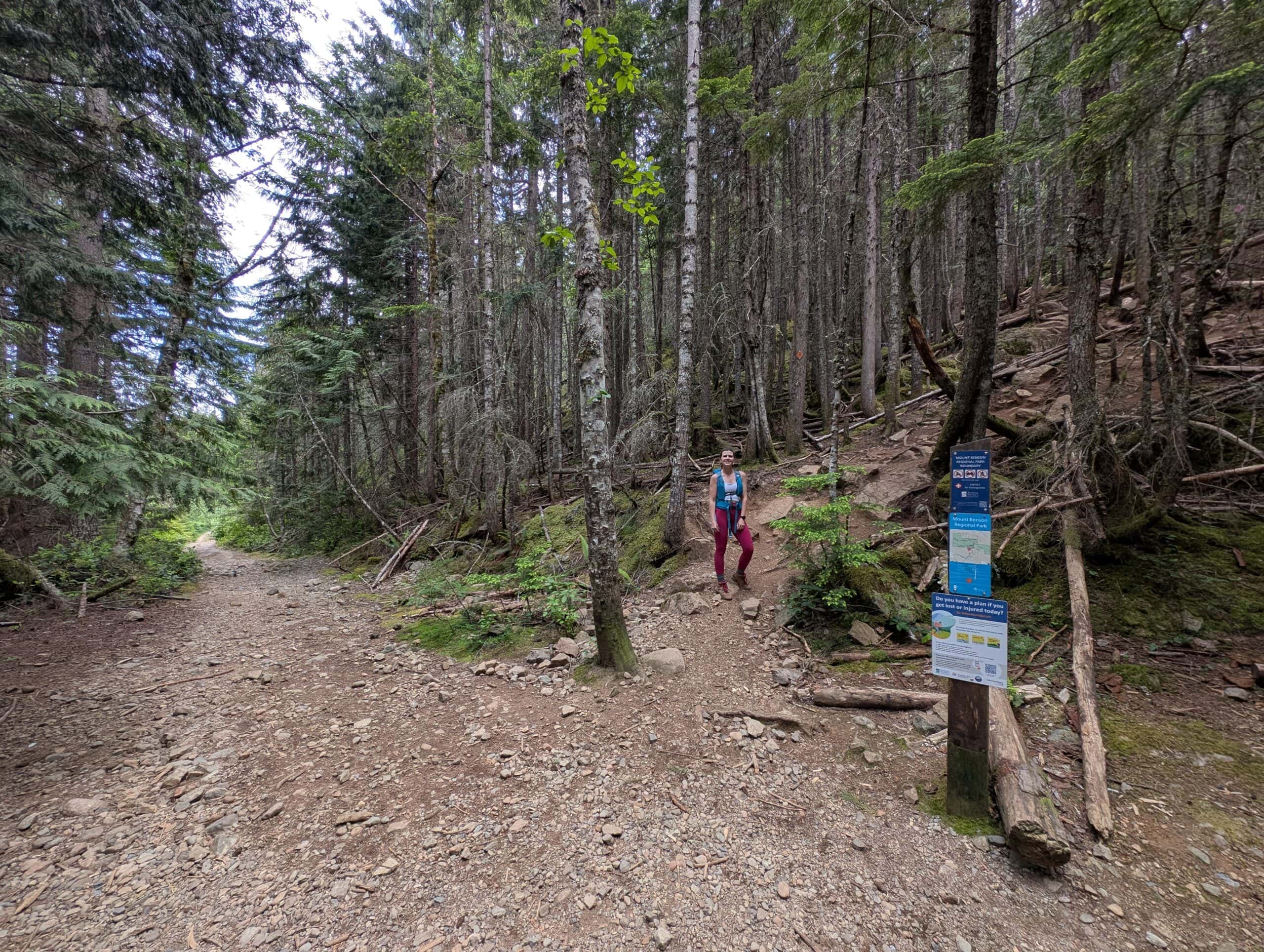
There are several different starting points and routes to go up, but the one I usually take starts at the new nice parking lot on Benson View Rd. There is ample room for all types of vehicles, trail signs and washroom in the car park.
There is a large trail map at the beginning of the hike and it make the route fairly easy to find.
There are many paths and different hiking routes up, so you have to be careful not to make wrong turns on your way up. Most of them will all reach the top, but some are definitely longer than others and many are mountain bike paths that will steer you in directions that won’t ascend up the mountain.
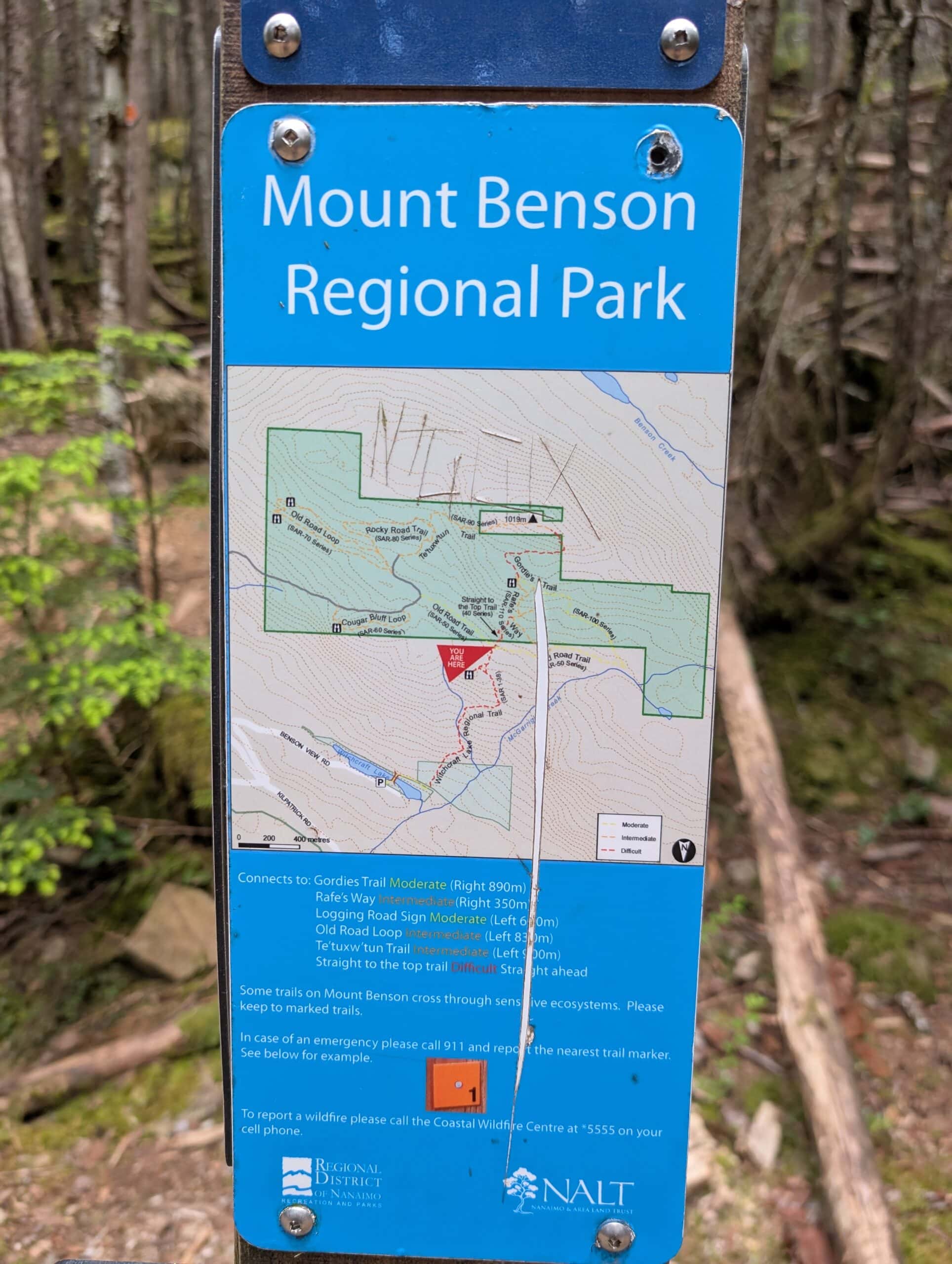
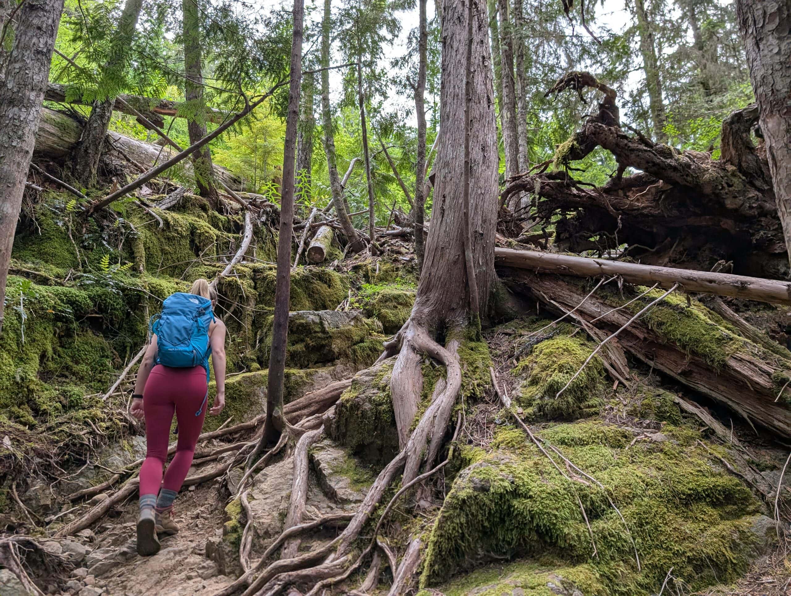
You will see signs along the way, so just make sure to follow the directions. The trail is mostly hard packed dirt through the trees, but on a rainy day it can get quite muddy.
Trekking poles can be helpful on this hike. Make no mistake it is steep and very much a grind.
After about an hour or so of up you will see a pull of to your right that leads to this lookout. This is a great spot to have a snack and either push on or turn around if your just out for a short hike.
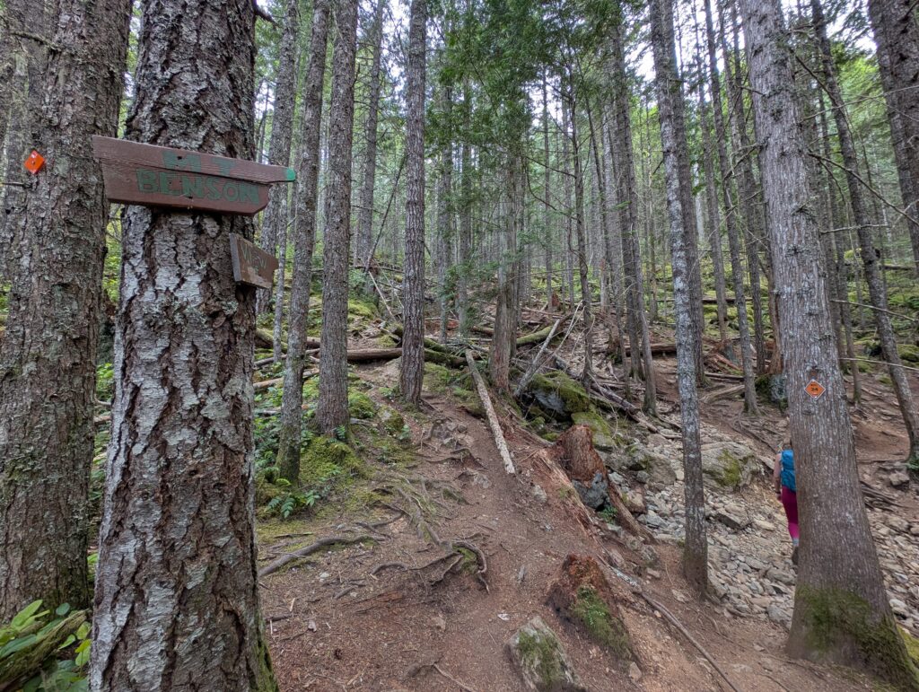
You will soon see a fork to a viewpoint and or the summit. Take the trail to the right to continue up!
After the 1st lookout you will walk onto a logging road. Cross the road and head straight up where Meghan is here.
If you are finding the elevation tough you can turn right on the logging road for a longer less steep ascent.
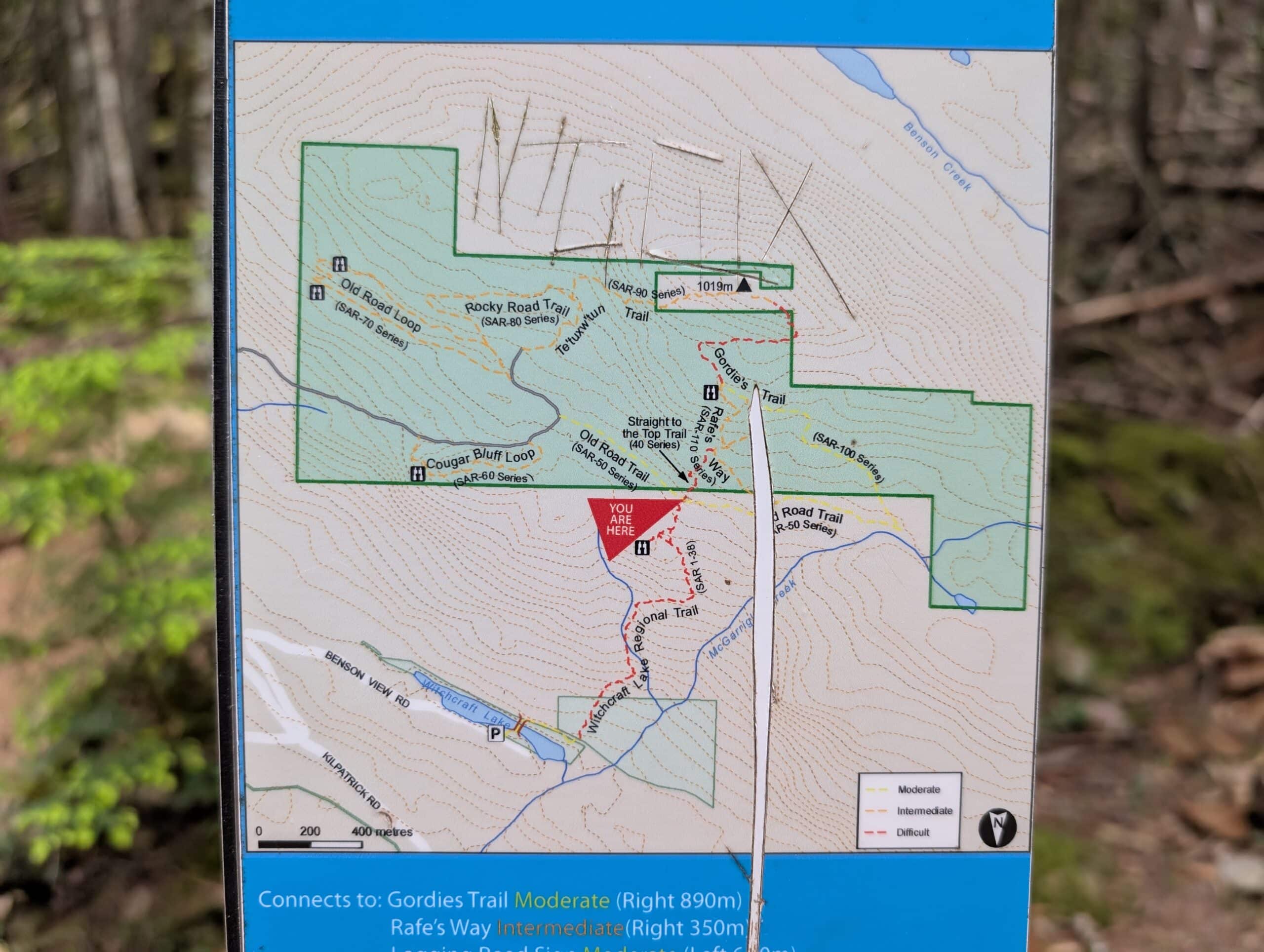
It really is choose your own adventure with the trail options. Personally I like teh straight up short route heading up Rafe’s way and Gordies Trail and then coming down Te’tuxwtun.
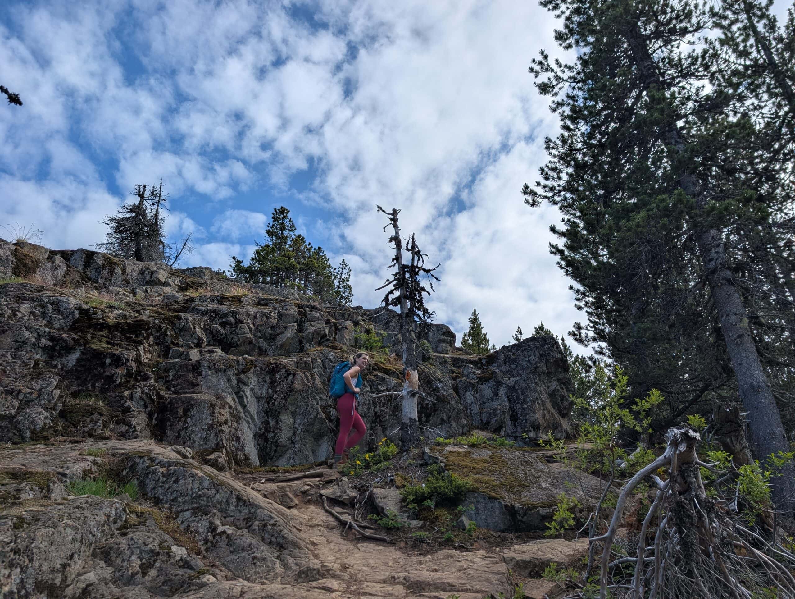
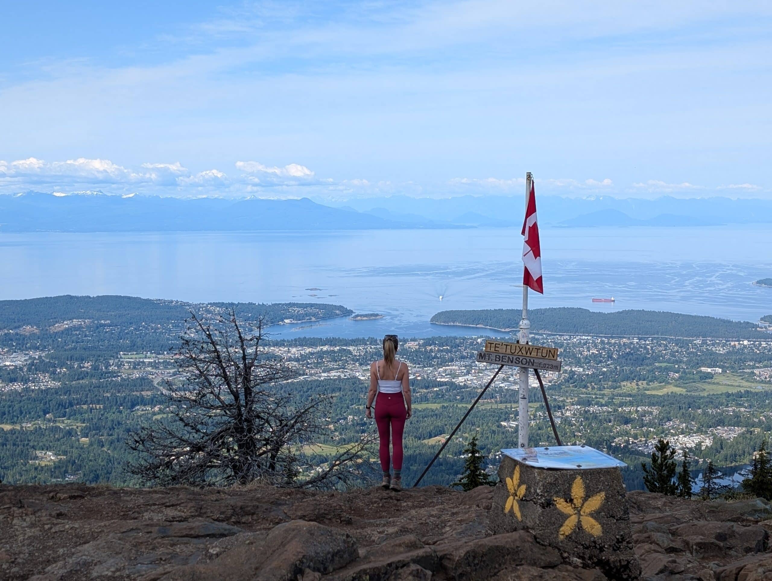
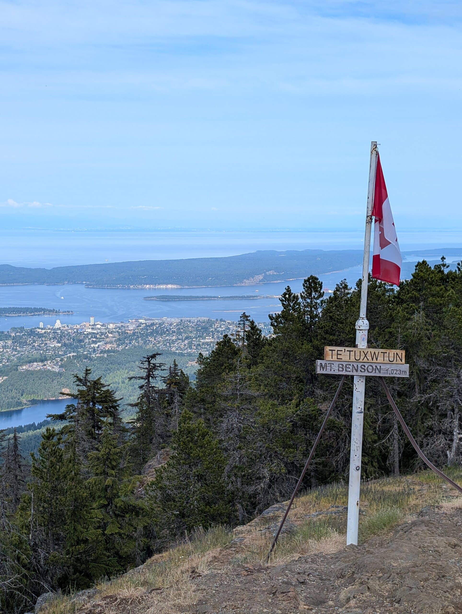
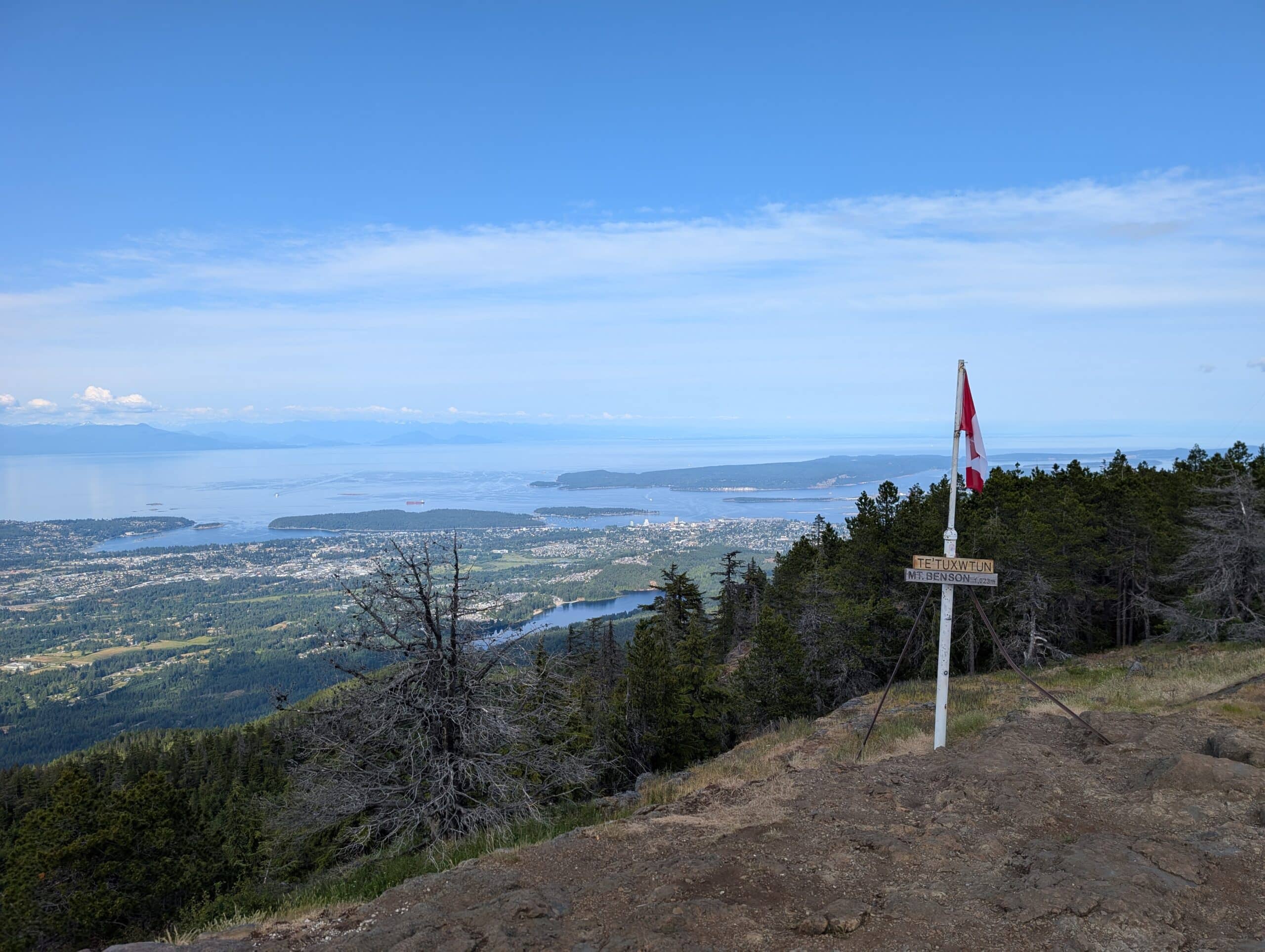
Soon you will see the trail start to open up into a rocky area. The last final ascent is really steep, but it is rewarding to finally reach the summit to take in the view. The summit has a small radio tower on top and a Canadian flag.
Mount Benson Summit Views
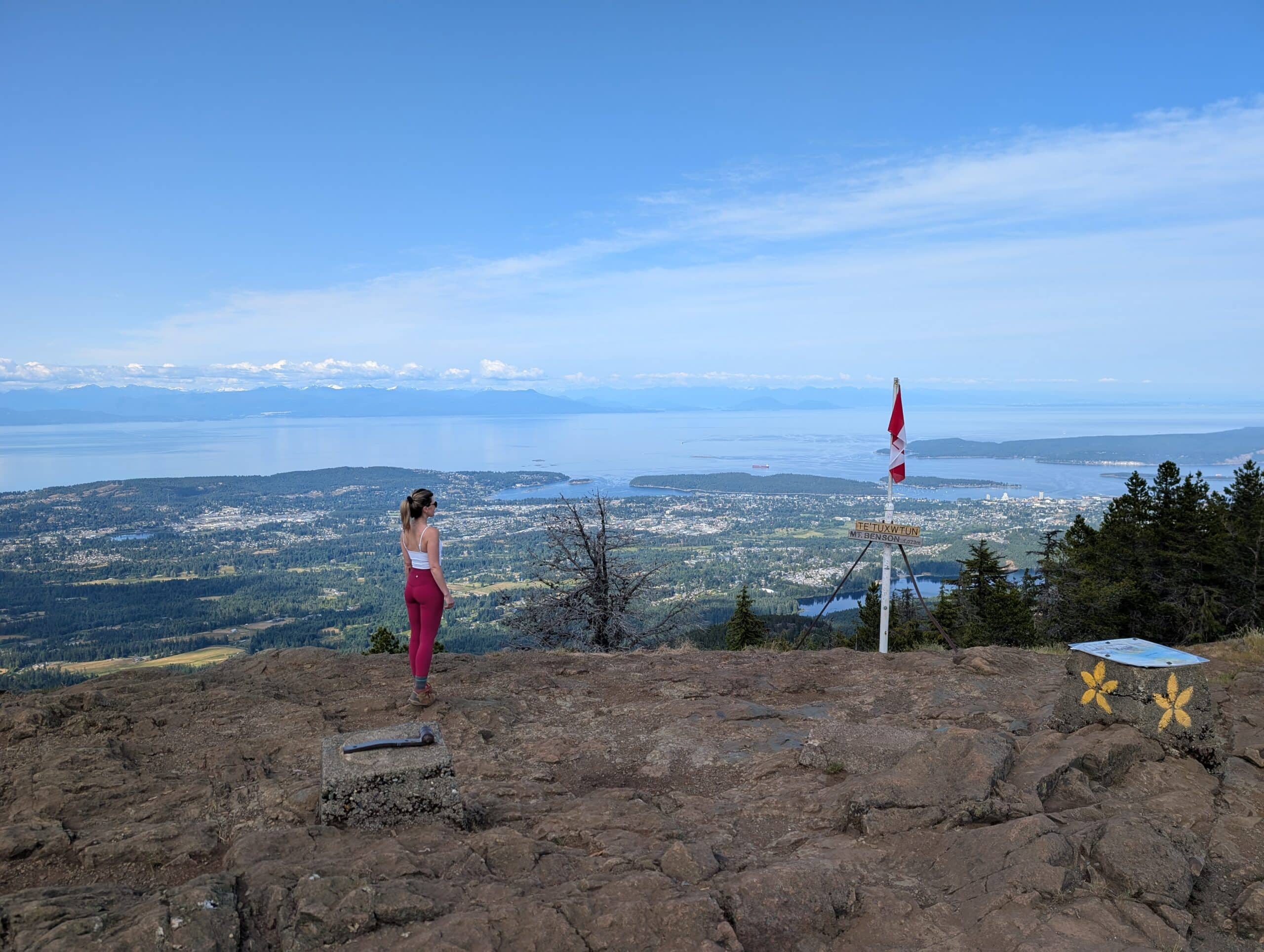
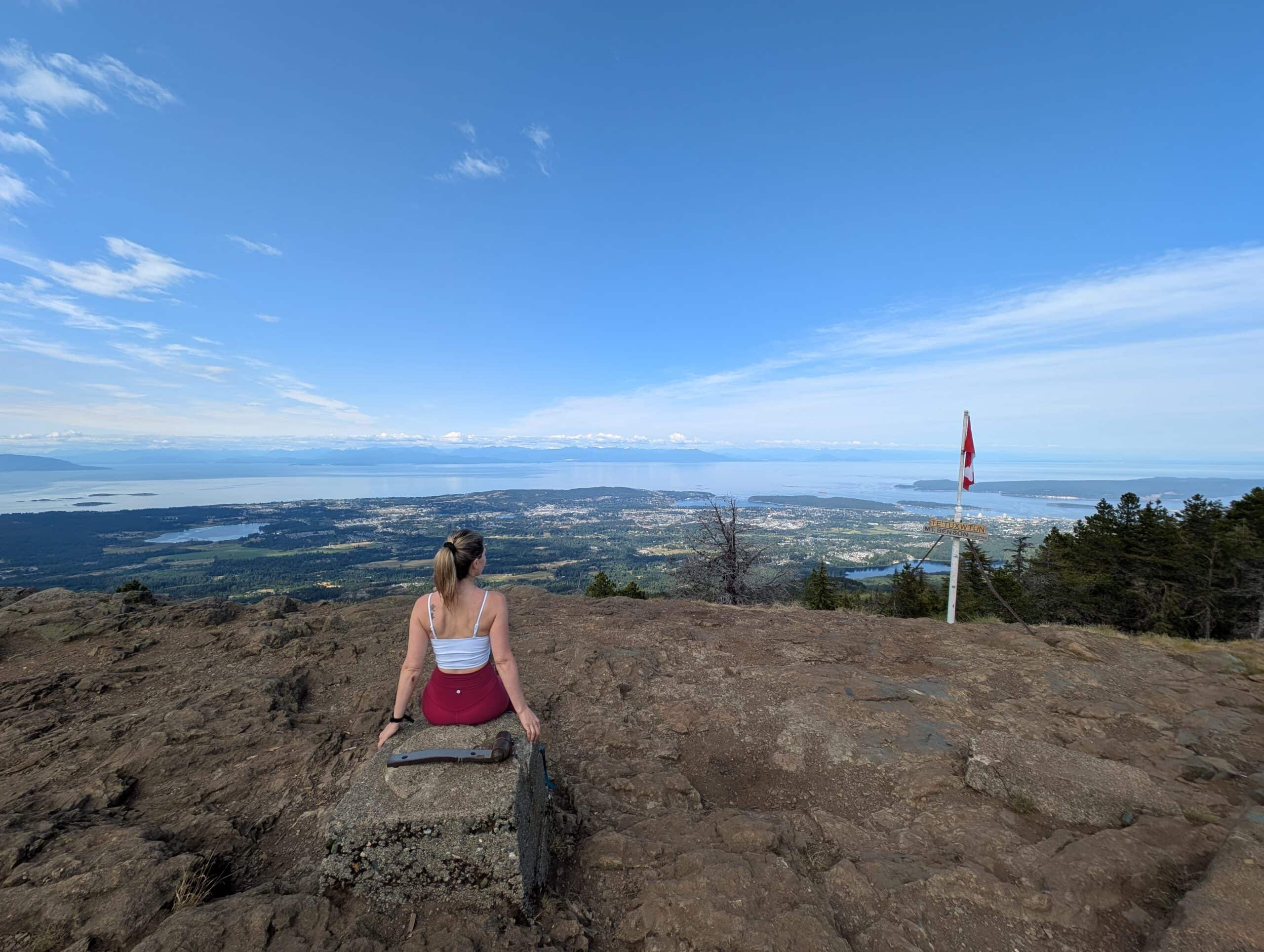
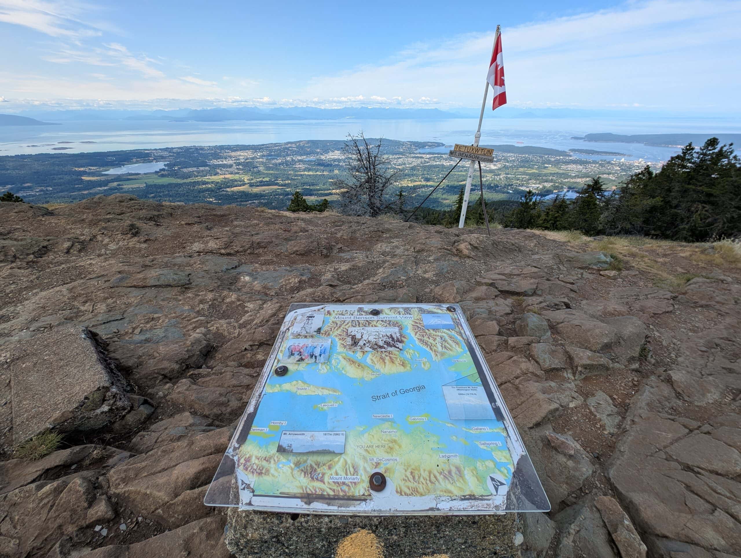
If you get a clear day the views can be super impressive. You can clearly see vancouver the Gulf islands and the whole Sechelt peninsula.
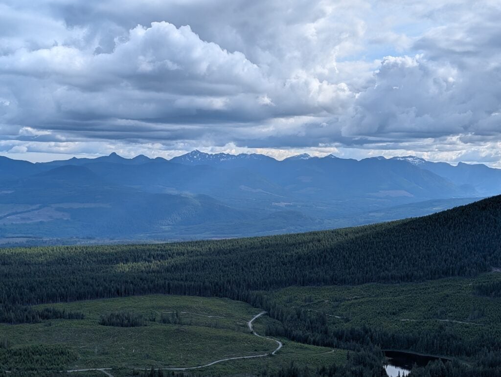
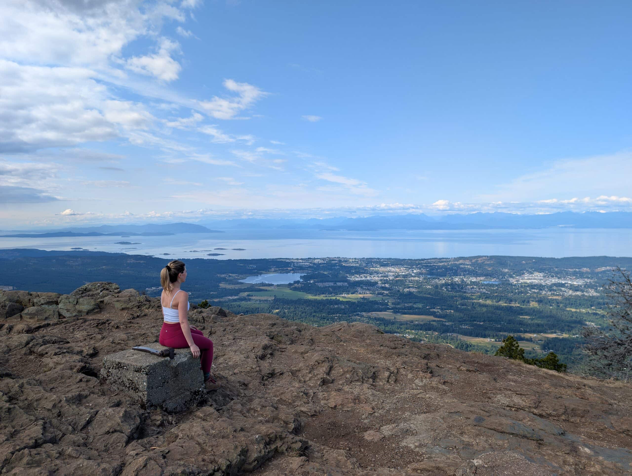
Looking away from Vancouver and the Georgia Strait.
Mount Benson Driving Directions

The trail head of Mt. Benson is located on Benson View Road. The parking is large and very easy to find on google just enter Mt Benson regional park and it will take you straight there. There is a large trail map at the beginning of the hike. Google maps directions are below.

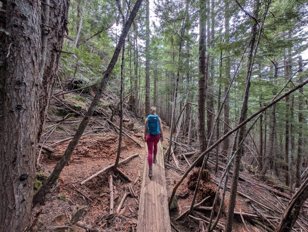
Heading down Te’tuxwtun trail and back to the car!
If you feel like checking out more of Nanaimo, I highly recommend Ammonite Falls!
Mt Benson Hike FAQ
The hike up Mt Benson feels more difficult than the stats indicate. I rate this hike as difficult, prepare accordingly and bring water and layers.
In summer the gates open at 5am and close at 11pm In winter the gate closes earlier at 8pm.
No, Benson has a great lookout spot about 1/2 way up which gives you fabulous views and a good turn around spot.
Officially you are not allowed to camp on the summit of Mt Benson
The summit of Mt Benson sits at
The start of the hike is difficult to reach with public transit. If you don’t have a car and are visiting we recommend renting a car with Expedia or biking.


3 Comments